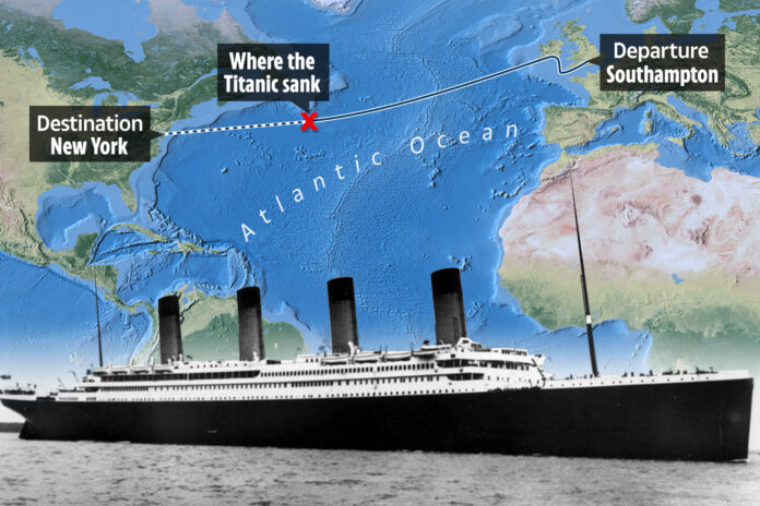
One of the most tragic marine disasters in history, the sinking of the Titanic, is no longer a mystery thanks to the wonders of technology.
The British passenger liner, which met its untimely end on April 14, 1912, now has its resting place easily accessible on Google Maps.
The Titanic, once labeled as “unsinkable,” collided with an iceberg during its maiden voyage from Southampton, England, to New York City. The largest ship afloat at the time, it was built by Harland and Wolff in Belfast. Despite being just 715 miles away from Halifax, Canada, and 1,250 miles away from New York City, the ship’s lookout Frederick Fleet’s warning about the iceberg came just a little too late.
The ship wreckage now lies 13,000 feet underwater in the Atlantic Ocean, where it was discovered in September 1985. The exact coordinates of the Titanic’s grave site can now be found on Google Maps, allowing users to explore the area where the tragic collision took place. The coordinates to be entered are 41.7325° N, 49.9469° W, revealing just how close the Titanic was to reaching its final destination.
The successful 1985 expedition that led to the discovery of the Titanic’s wreckage was not just a simple search mission. Led by Robert Ballard, the expedition was part of a covert US military operation to find lost nuclear submarines. Ballard’s hunt for the Titanic was a front for the real mission to locate the submarines before the Russians could find them, changing the course of the Cold War submarine race.
After finding the Titanic in record time, Ballard and his team were struck with a sense of sobriety and respect for the shipwreck. They promised to treat the site with the utmost respect, acknowledging that they were dancing on someone’s grave.
While the discovery of the Titanic may have solved one of Earth’s greatest mysteries, the memory of the tragedy and loss of life still lingers on.

